Winter weather ahead: Clark County Public Schools closed Thursday
Published 7:30 pm Wednesday, January 19, 2022
|
Getting your Trinity Audio player ready...
|
Tomorrow, Thursday, January 20th, Clark County Public Schools will be operating as a Non-Traditional Instruction Day (NTI Day). There will be no in-person classes. Please visit clarkschools.net or school websites for more information. The Test-to-Stay program will also be closed.
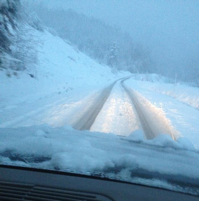
On that note, up to three inches of snow is expected to fall across Kentucky on Wednesday night into Thursday, prompting the National Weather Service to issue a Winter Weather Advisory for all but far western and far northern parts of the state.
Mike Kochasic with the NWS Louisville office said rain will change over to a wintry mist during the evening, then to snow during the overnight hours.
“The main impact we’re looking at is icy and snow-covered roads, with definitely some hazardous travel with some sloppy roads for those traveling overnight and for the Thursday morning commute.”
While temperatures rebounded after the last snowstorm, that won’t be the case this time, according to Kochasic. “Once this event ends, Thursday through early next week we’ll see a lot of sunshine, but it will be cold as a big high pressure moves in. The big impact here, especially on Thursday, will be patchy black ice possible if rain pools up in certain spots and the ground temperature drops below freezing overnight, in addition to any snow or slush.”
He says their main message is travel impacts. “Roads will be sloppy due to ice and snow, so take it slow, leave extra distance between you and the vehicle in front of you, and allow for extra travel time, especially for the Thursday morning commute, which is when we’ll see the greatest impact.”
The Kentucky Transportation Cabinet says their crews are geared up for the winter event, and in some areas are asking drivers to avoid unnecessary travel, while the advisory is in effect.
“Rapidly dropping temperatures through the evening will make it likely elevated surfaces such as bridges and overpasses will ice over fairly quickly,” said Keith Todd with the Paducah Highway office. “The freezing drizzle, freezing rain, and sleet in the early hours of this winter event, are likely to limit the ability of highway crews to improve driving conditions once the temperature drops. Salt and other ice-fighting chemicals have minimal impact below about 16 degrees.”